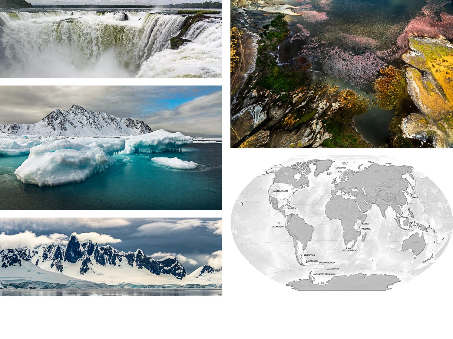
This series of naturescapes takes you to sites of fragile natural beauty on six continents, including: deep in the Colorado River’s Grand Canyon; within the Arctic Circle and on the Antarctic Peninsula; to the massive Iguazu Falls between Argentina and Brazil; and high above Kenya’s soda-infused Lake Magadi, which can draw enormous flocks of flamingos.
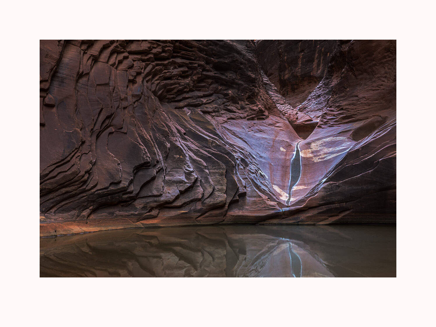
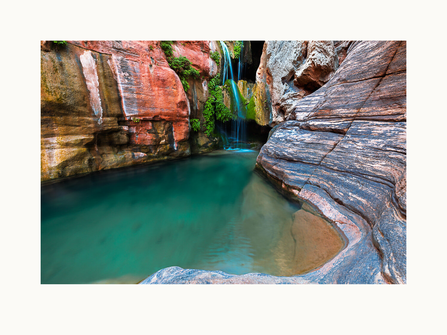
Erosion of Supai sandstone has carved swirling patterns around this North Canyon pool, a popular (and cool) hiking destination for river runners, less than a mile from the river. Grand Canyon National Park – River Mile (RM) 21, United States, 2018.
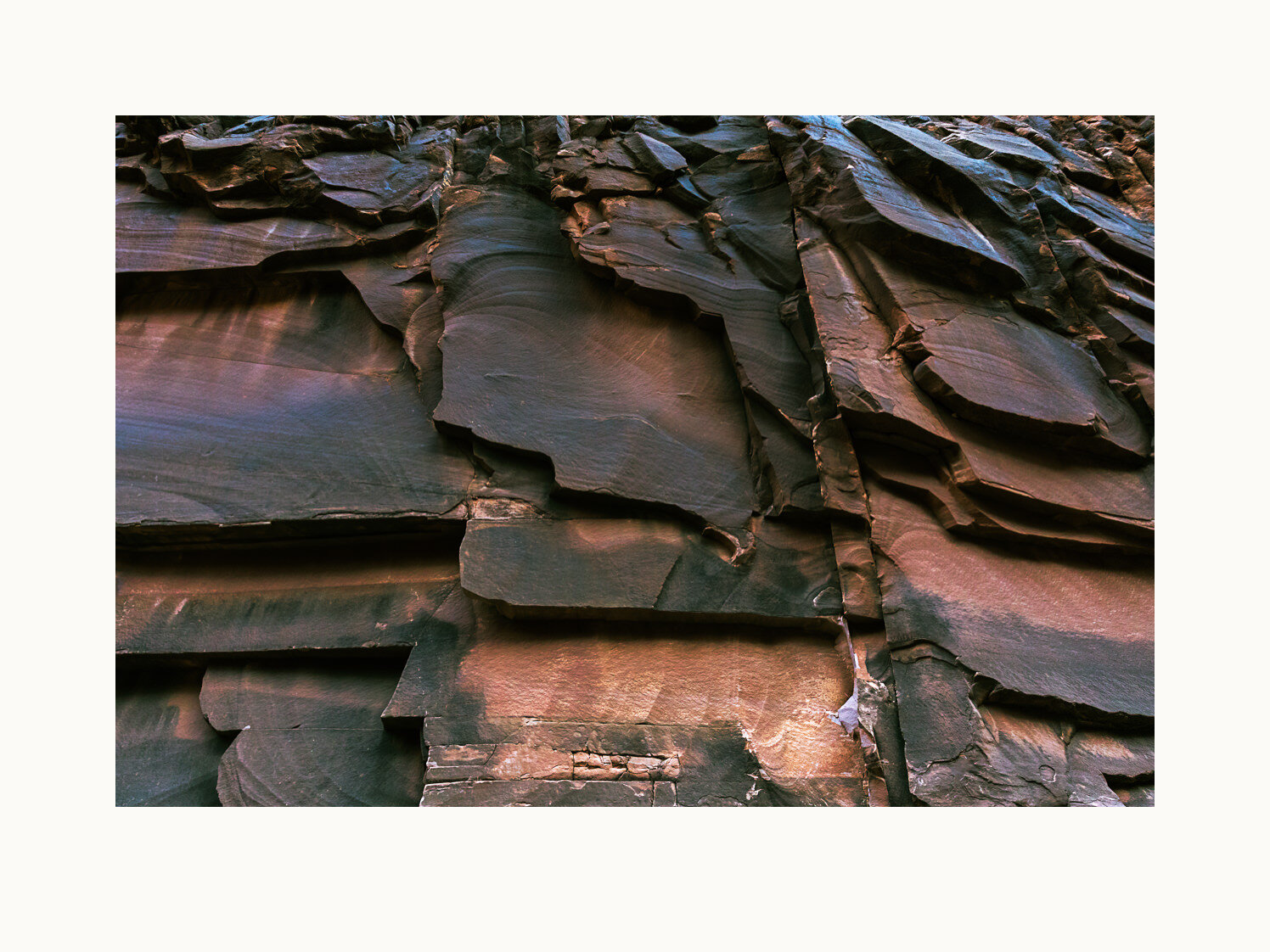
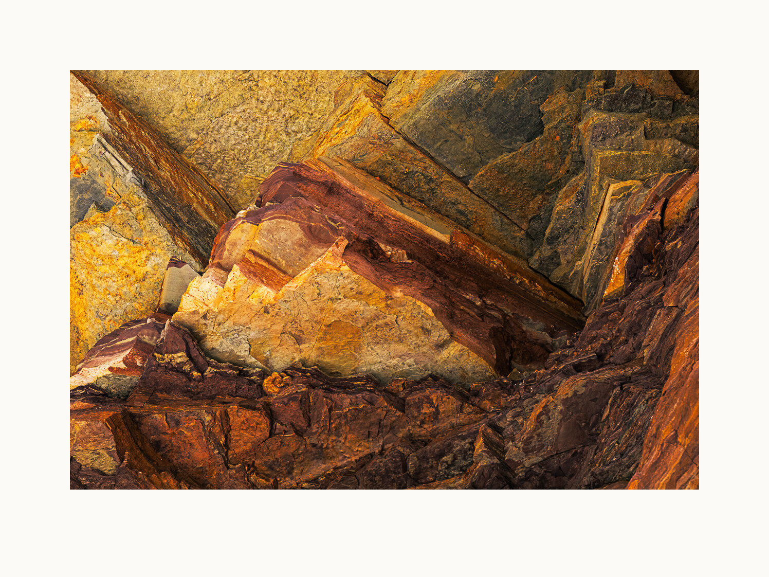
Broken layers of Supai sandstone form an abstract wall segment in North Canyon, a popular hiking break for river runners, who often camp where it meets the Colorado, just below House Rapid, the first major rapid. Grand Canyon National Park – RM 21, United States, 2018.
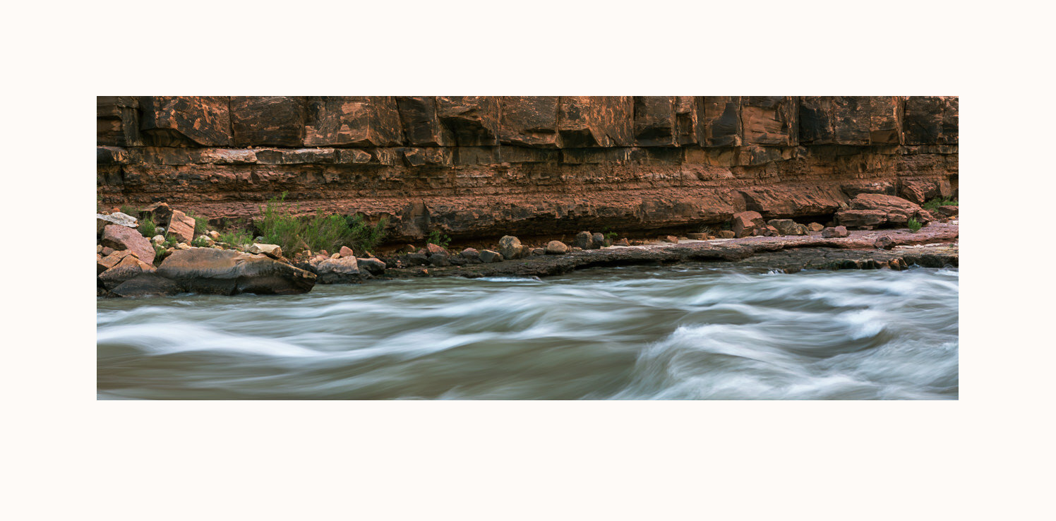
A view from the campsite, looking across rapids created by North Canyon debris flows. Grand Canyon National Park – RM 21, United States, 2018.
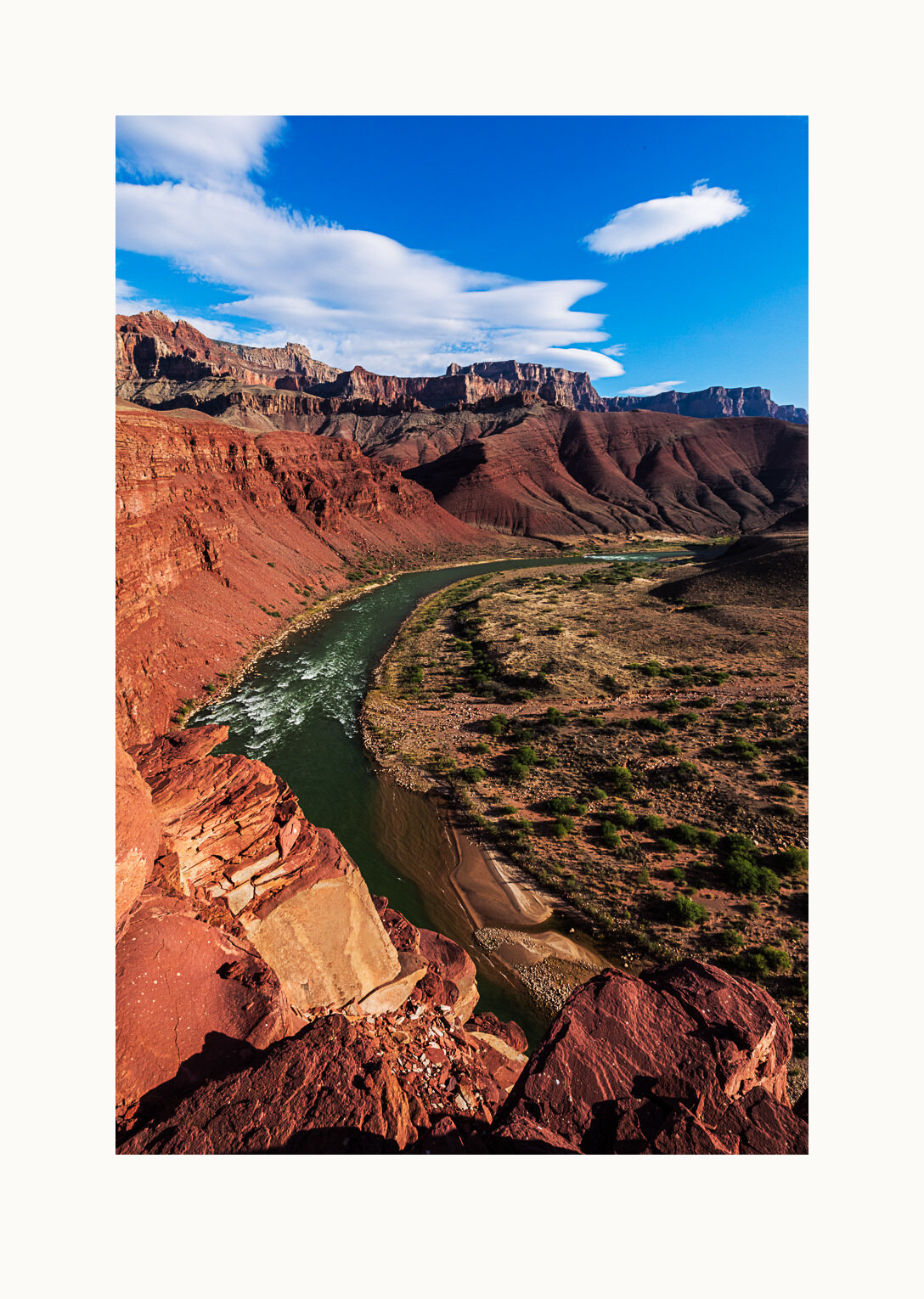
A late afternoon view down the Colorado River from the Nankoweap Granaries trail. High in the canyon walls to the right and behind us, at about 1100 AD, ancestral Puebloans cut caves into the cliffs. They hauled grain (including pumpkin seeds and corn) from the river delta below to those caves for storage. Grand Canyon National Park — RM 53, United States.
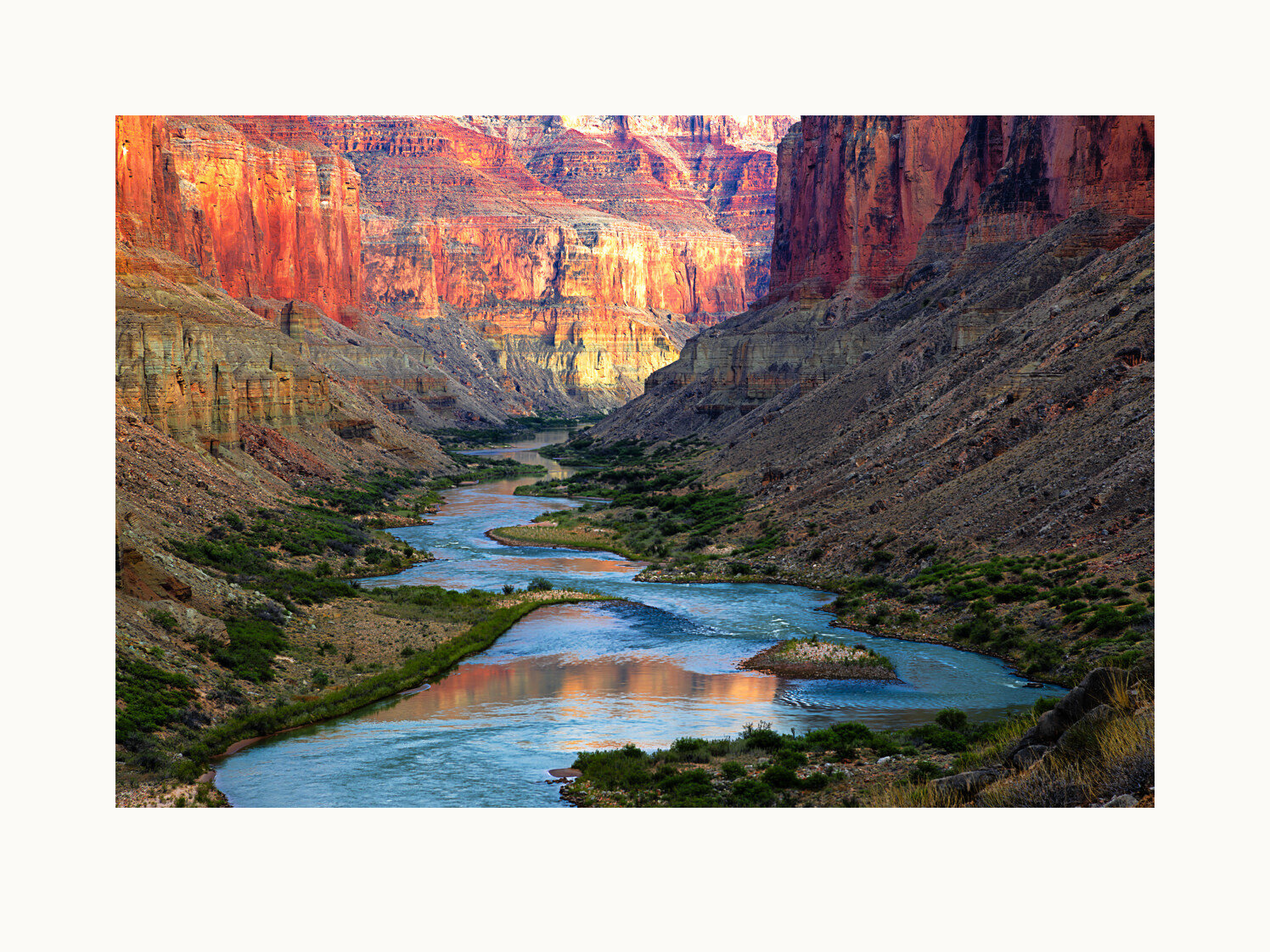
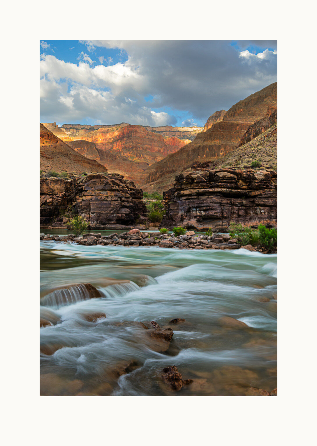
The confluence of the Little Colorado River with the Colorado is a sacred place for Native peoples. For the Hopi, it is where life began. For the Navajo, is a place to share their prayers, the overall Little Colorado drainage their current home. Early morning light adds reverence to the scene. Grand Canyon National Park — RM 61.5, United States, 2018.
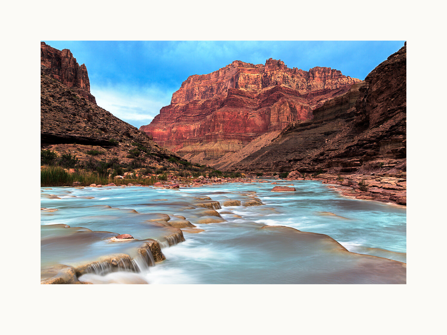
A brilliant turquoise-blue color enters the Little Colorado at Blue Spring, about 13 miles above the confluence, with suspended calcium carbonate minerals. The confluence area is threatened with development. One decade-long campaign to build a 420-acre resort hotel at a nearby canyon rim site, with an elevated tramway carrying up to 10,000 visitors a day to the confluence area, was finally ended by decisive votes of the Navajo Nation in 2017 and 2018. Grand Canyon National Park – RM 61.5, United States, 2018.
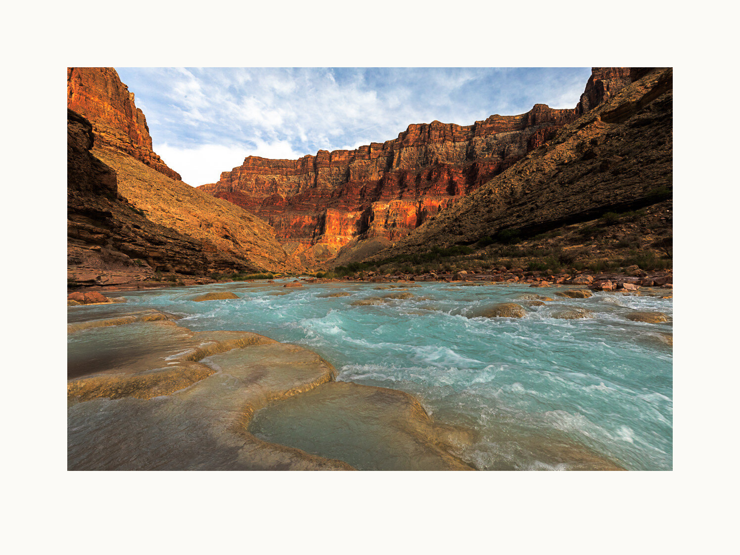
Despite the beauty and sacred inheritance of the confluence area, development proposals keep coming. One newly proposed project would create a large hydro-electric power complex in the area, with multiple dams and a large power generation facility. Grand Canyon National Park – RM 61.5, United States, 2018.
The expansive view from the overlook includes the large delta deposited by Unkar Creek, wrapped by a hairpin curve of the Colorado. The delta was inhabited by ancestral Puebloans; rectangular outlines of rock identify locations of their dwellings. Grand Canyon National Park – RM 71.5, United States, 2018.
This lovely shaded grotto is popular as a swimming hole during hot summer days after a hike up from the Colorado River. Grand Canyon National Park — RM 117, United States, 2018.
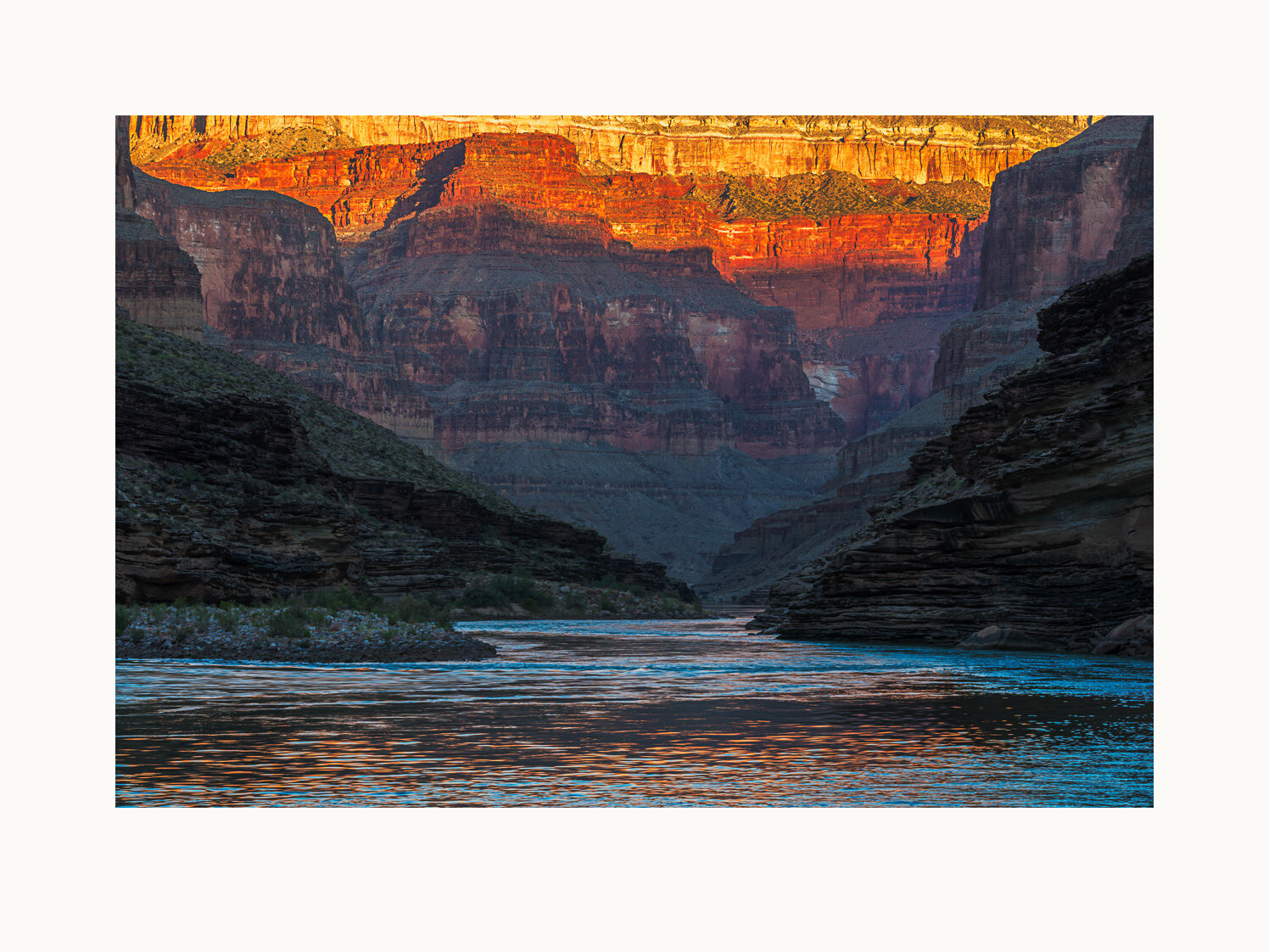
More than 1,000 feet below the rim, the river is still shrouded by massive cliffs of redwall limestone in this view from Blacktail Canyon. The name of this stretch of the river was intended to honor Spanish explorers of the South Rim, but it’s not clear that any of the specific honored men were conquistadors. Grand Canyon National Park – RM 120.5, United States, 2018.
Deer Creek meets the Colorado in a 150-foot waterfall. Viewed from well above the top of that waterfall, the green river stretches downstream. Grand Canyon National Park – RM 137, United States, 2018.
Upstream from its 150-foot fall to join the Colorado, Deer Creek has formed a verdant patio, reached by a challenging climb up from the river. The patio walls abound with rock puzzles like this one. Grand Canyon National Park – RM 137, United States, 2018.
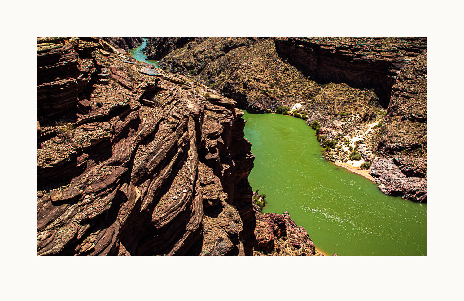
Three Springs Canyon is viewed here from the final campsite on this trip, across minor rapids of the same name. Grand Canyon National Park – RM 216, United States, 2018.
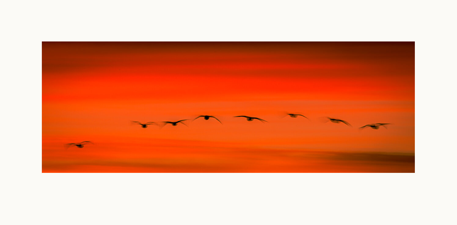
Sandhill cranes migrate to this central New Mexico area for the late October to late January winter. Historically, they came for seasonal wetlands created by the Rio Grande River. Those wetlands are gone now, with dams and other drastic changes in the river. Wildlife refuge staff, in cooperation with local farmers, use river water to recreate in agricultural fields the key benefits of the wetlands for large flocks of migrating cranes, geese and ducks. Bosque del Apache National Wildlife Refuge, United States, 2012.
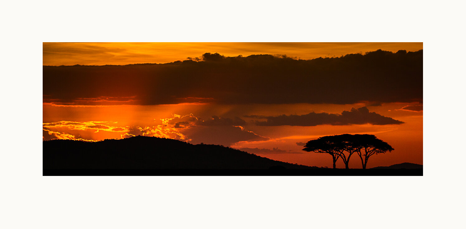
Acacia trees are silhouetted by a sunset. Serengeti National Park, Tanzania, 2014.
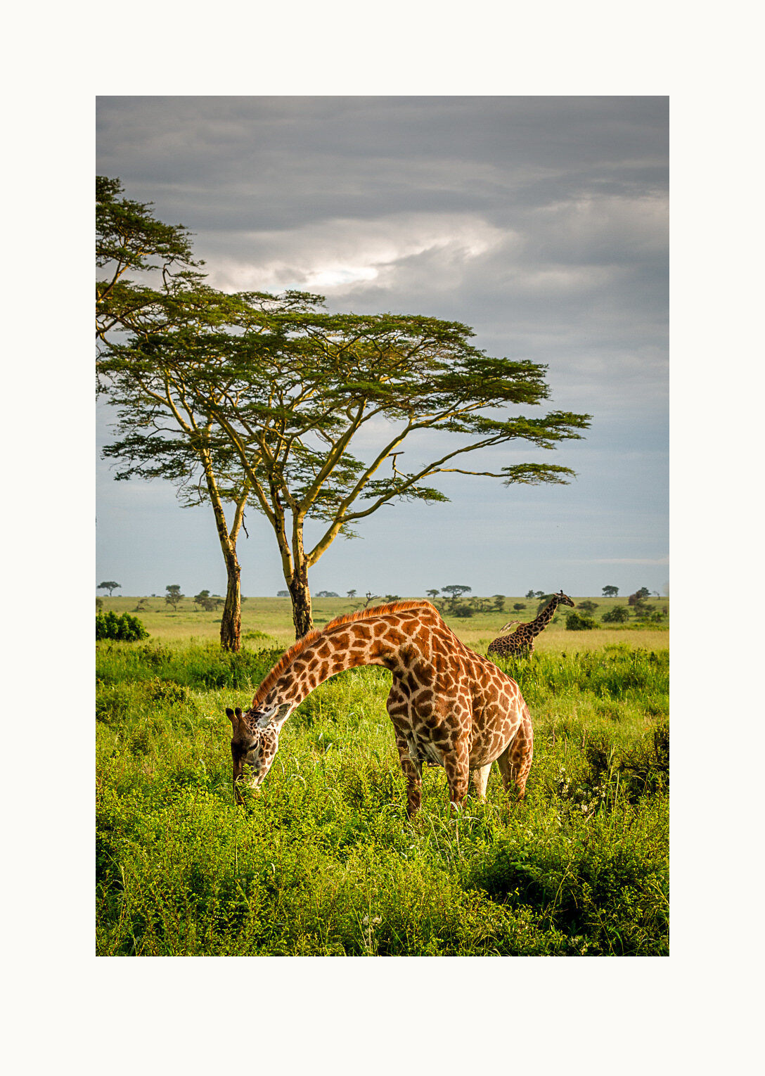
A pair of Masai giraffes feeding, with towering yellow-barked acacia trees in the background. Tower is the collective noun for a group of giraffes. Serengeti National Park, Tanzania, 2014.
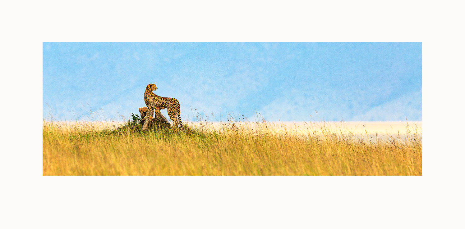
A cheetah mother and her five cubs monitor the plains for lions, a dangerous cheetah predator, especially for the cubs. Masai Mara National Reserve, Kenya, 2012.
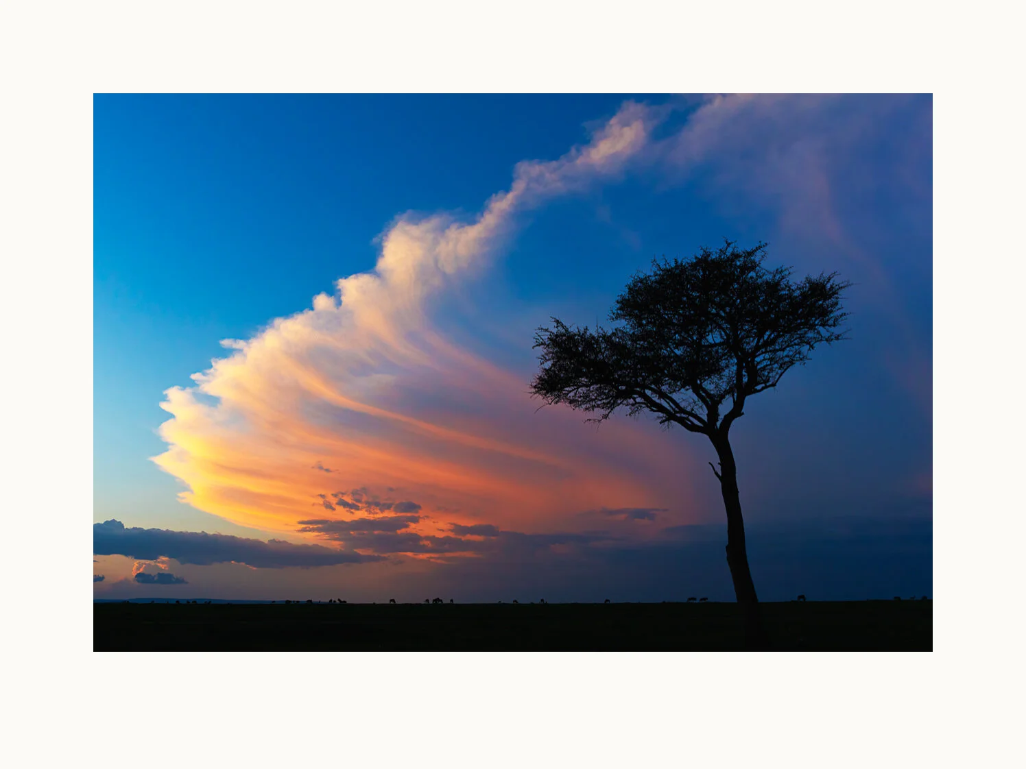
Towering September evening clouds and Mara wildlife on the horizon provide the backdrop for this solitary green thorn tree. Masai Mara National Reserve, Kenya, 2017.
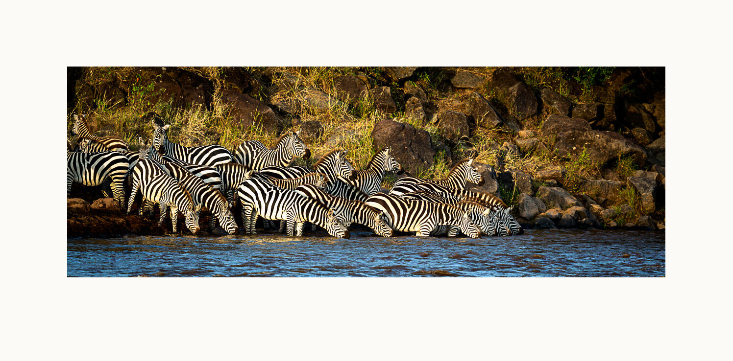
Migrating zebras at the edge of the Mara River prepare to cross, wary of the crocodiles that may be hidden in the water. Masai Mara National Reserve, Kenya, 2012.
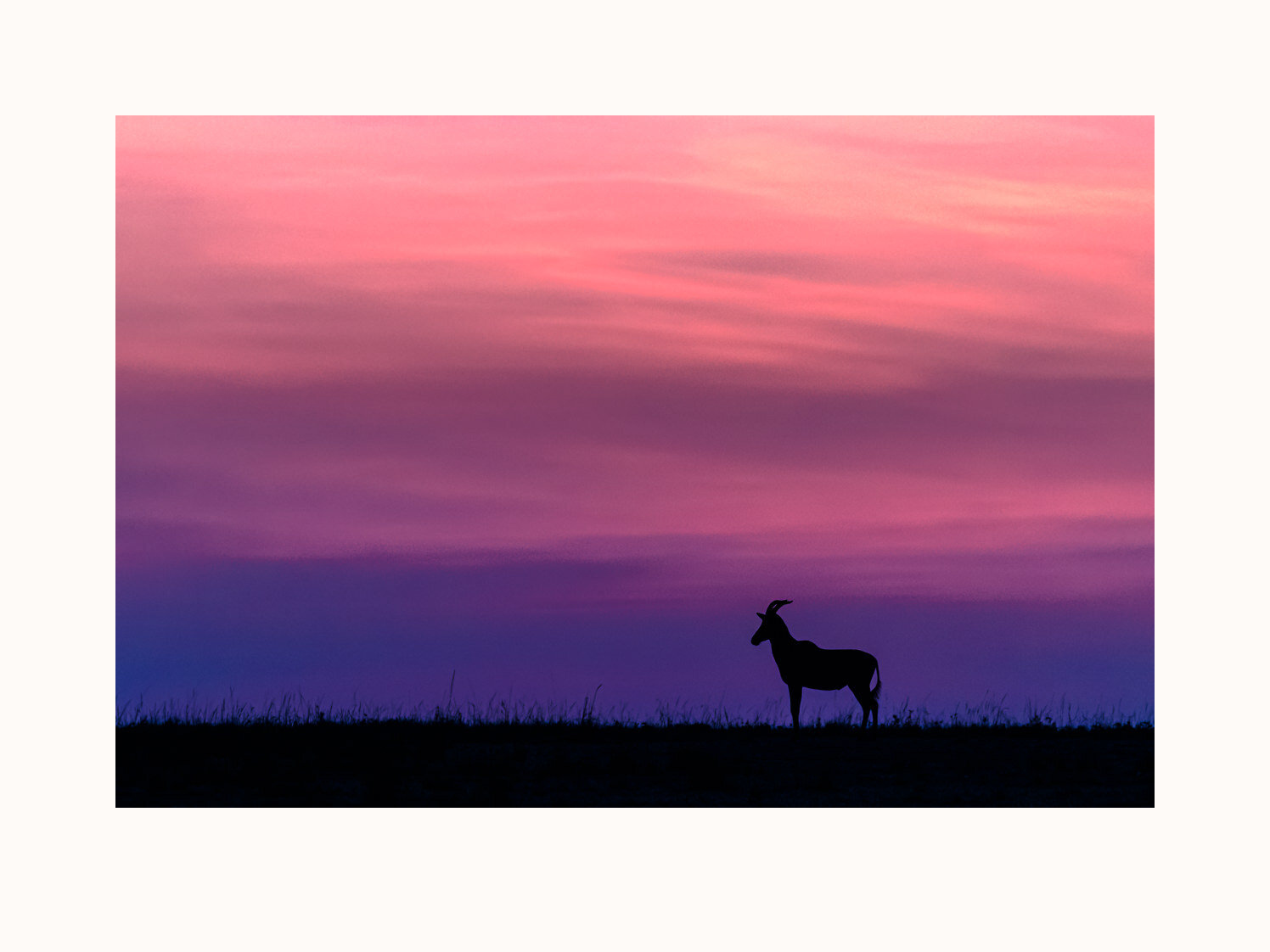
A solitary topi scans the nearby Mara from a ridge during sunrise. Masai Mara National Reserve, Kenya, 2017.
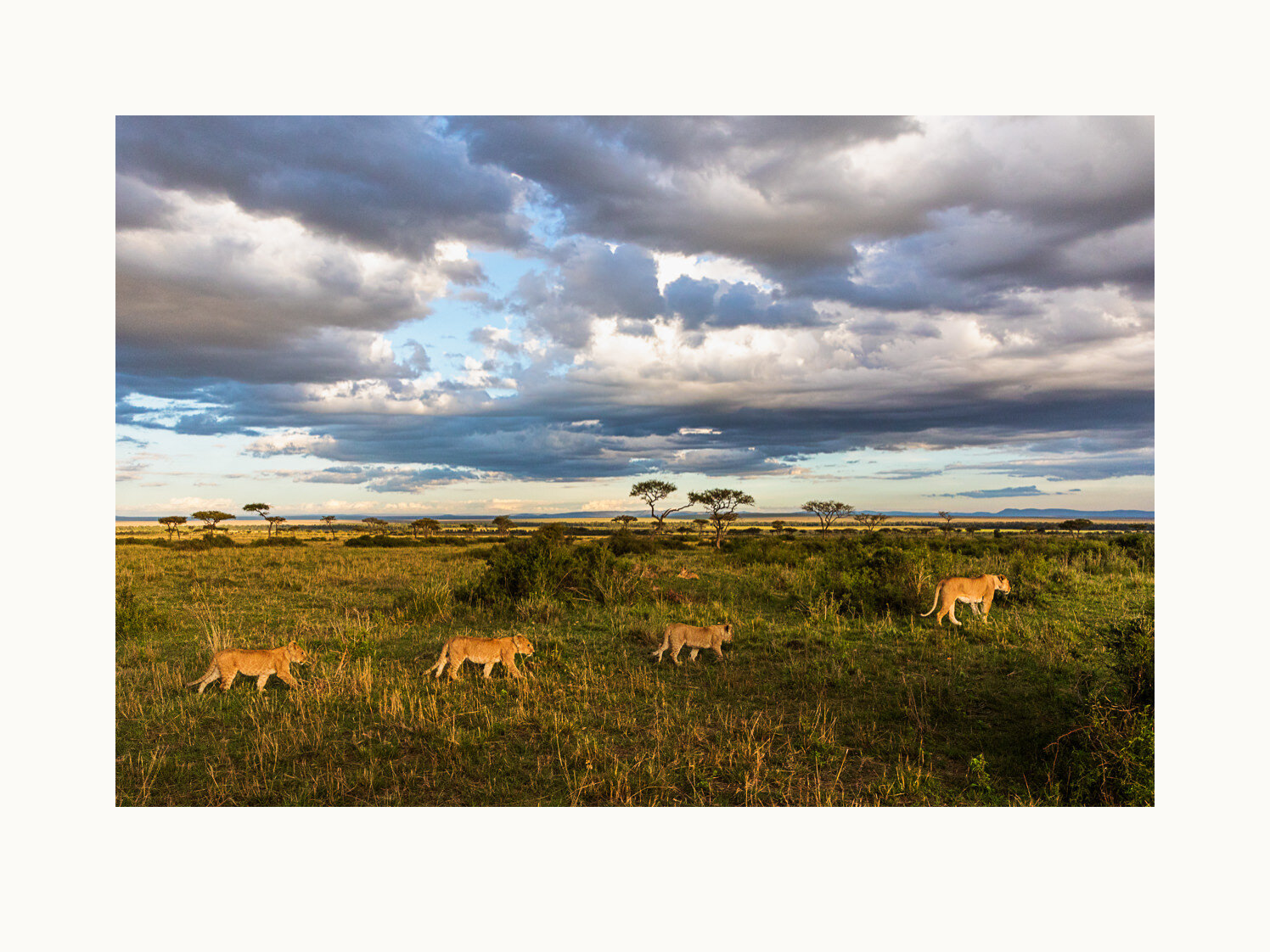
A lioness and her cubs traverse the Mara, quite likely headed out for an early evening hunt. Additional members of the pride lounge in the background. Masai Mara National Reserve, Kenya, 2017.
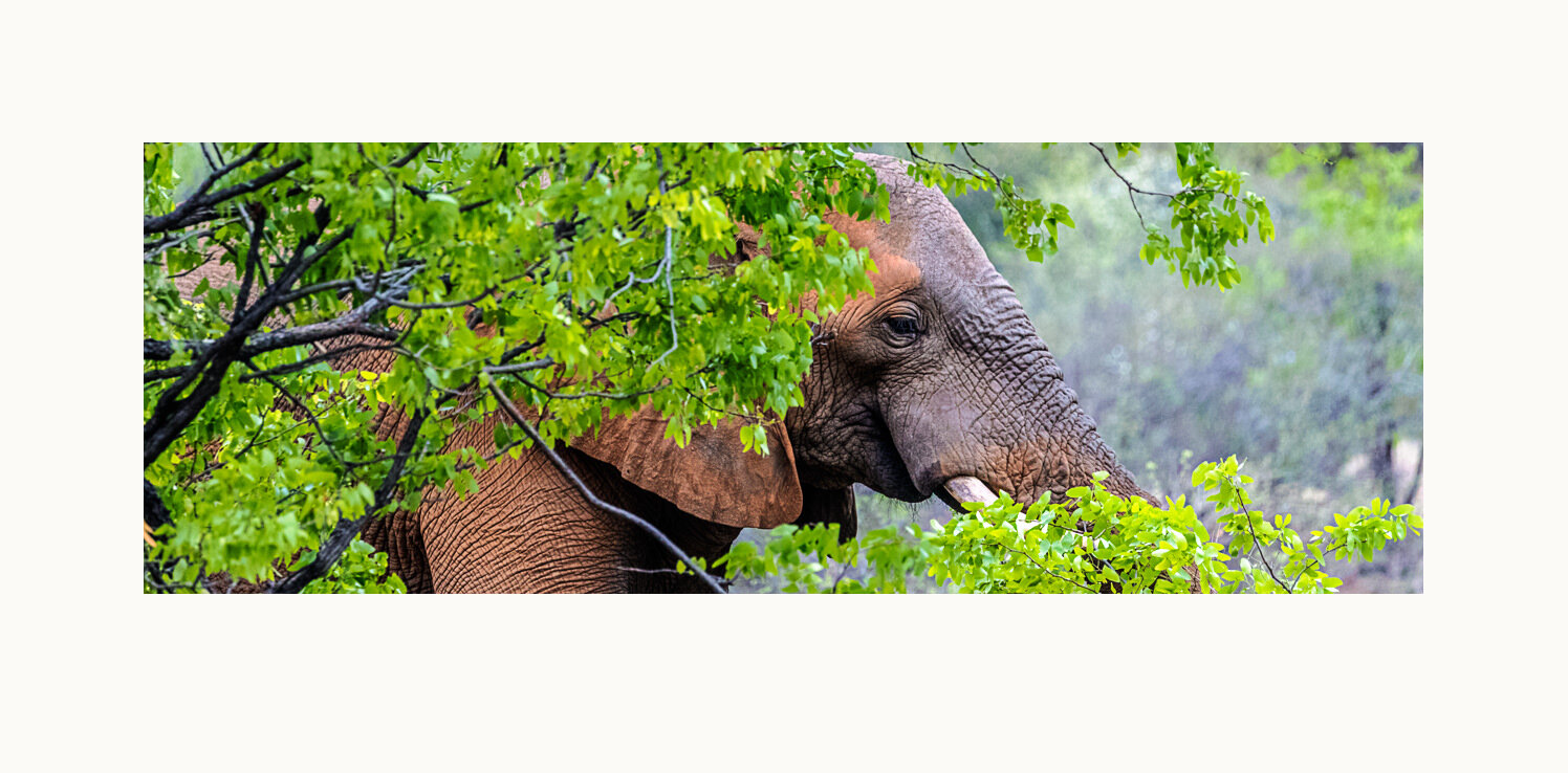
In the Makuleke region, the northernmost in Kruger, this elephant is coated with red dirt, contrasting beautifully with the new foliage during this late November green season. Kruger National Park, South Africa, 2018.
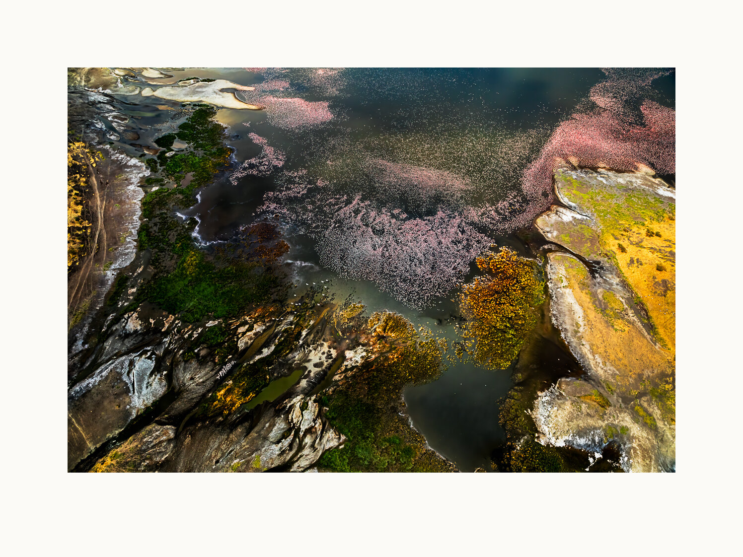
Lake Magadi, the southernmost of Kenya’s soda lakes, can draw enormous flocks of flamingos. The vistas during a doors-off helicopter flight over the lake were simply awesome. Flamboyance is a collective noun for flamingos. South Rift Valley, Kenya, 2018.
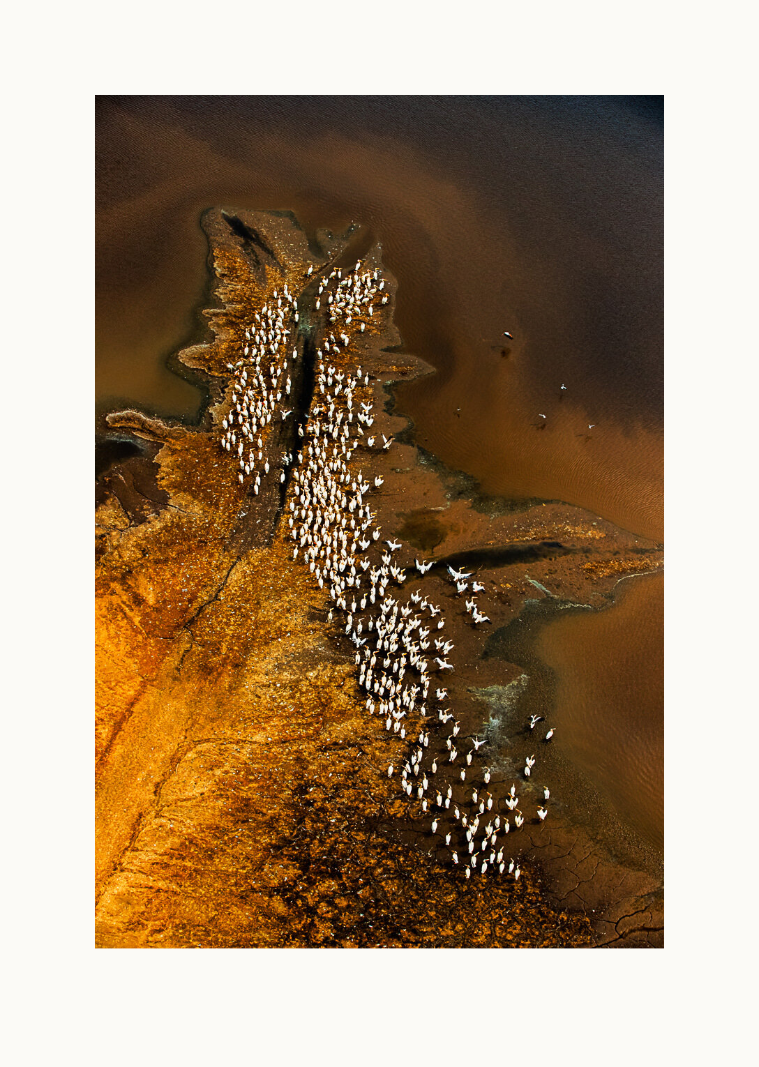
A flock of white pelicans rests on the colorful shores of Lake Magadi. Squadron is a collective noun for pelicans. South Rift Valley, Kenya, 2018.
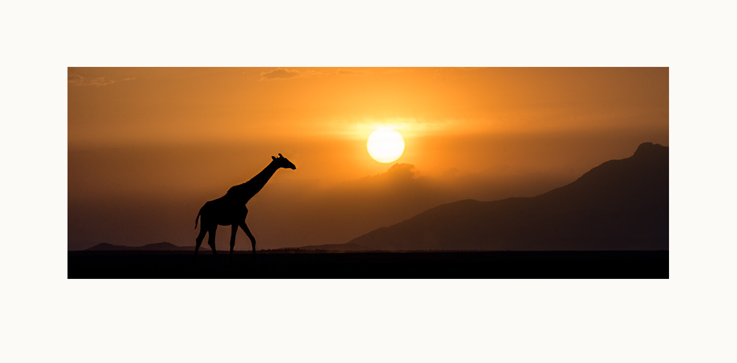
A solitary giraffe traverses a dry and dusty lake bed (or “pan”) at sunset. Amboseli National Park, Kenya, 2017.
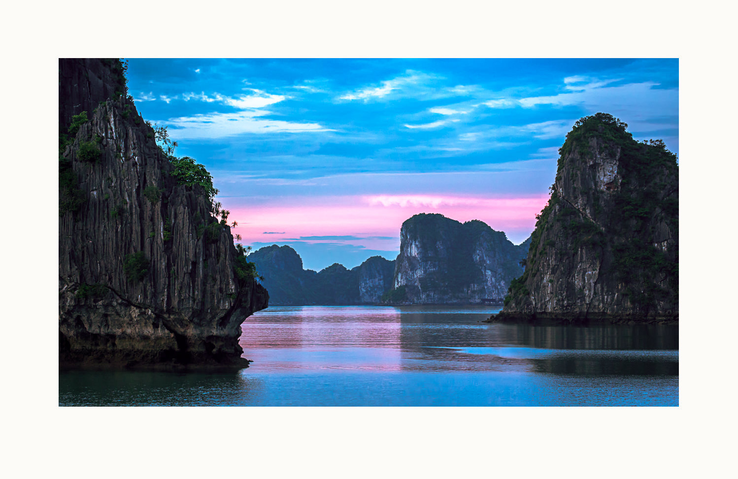
Ha Long (descending dragon) Bay features thousands of limestone karsts, islands and islets. According to local legend, ancient Vietnam had to fight against invaders. The gods sent a family of dragons as protectors and those dragons spit jewels, which became islands, blocking the invaders. Ha Long Bay, Vietnam, 2014.
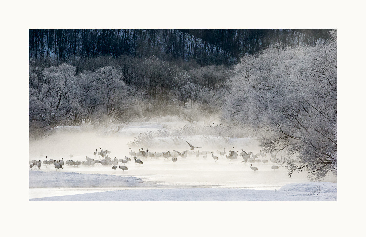
Red-crowned cranes roost overnight in the river because the water is warmer than the air and because they can more easily detect predators coming through the water. Here the cranes start to stir. A rare combination of temperature and moisture level in the air produces hoar frost on the shoreline trees. Setsuri River, Tsurui, Hokkaido, Japan, 2017.
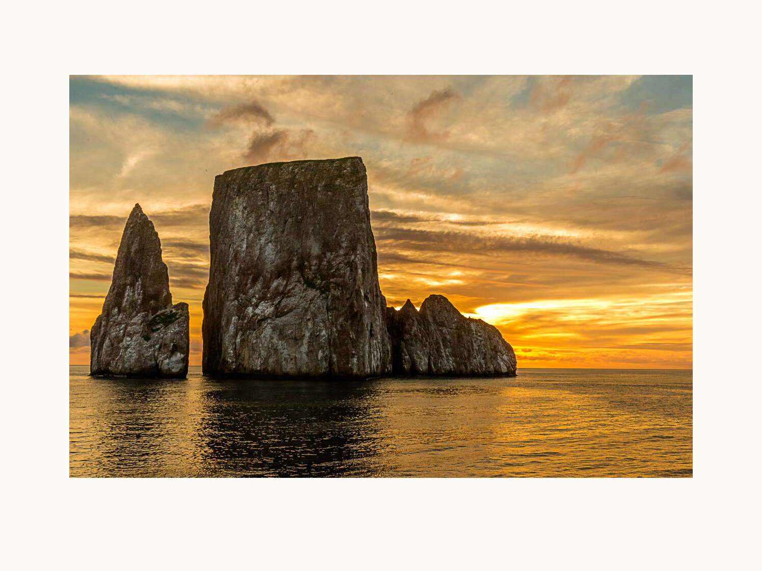
A sunset view of the remains of a lava cone that split in two over the years. The slot between the two is wide enough for tour boats to pass through. San Cristobal Island, Galapagos, Ecuador, 2015.
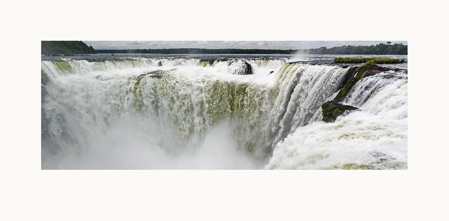
Roughly half of the Iguazu River flows occur through this part of this massive waterfall complex on the border between Argentina and Brazil. Iquazu Falls, Argentina, 2016.
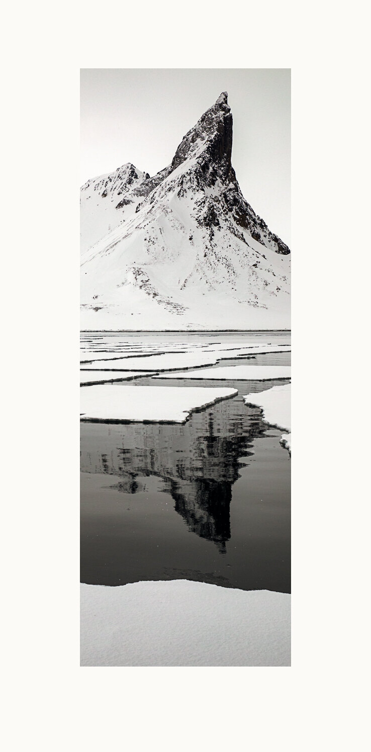
Sparse drift ice contributes to an abstract view of the Bautaen peak. Hornsund Fjord, Svalbard Archipelago, Norway, 2019.
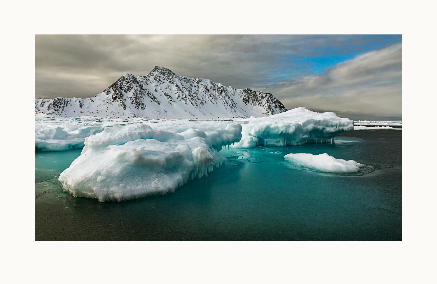
Submerged ice glows beneath the surface of the Fuglefjorden during a Svalbard zodiac cruise. Since 1971, the average Svalbard temperature has increased by about 7°F. The corresponding rise for winter temperatures is over 12°F. Fuglefjorden, Svalbard Archipelago, 2019.
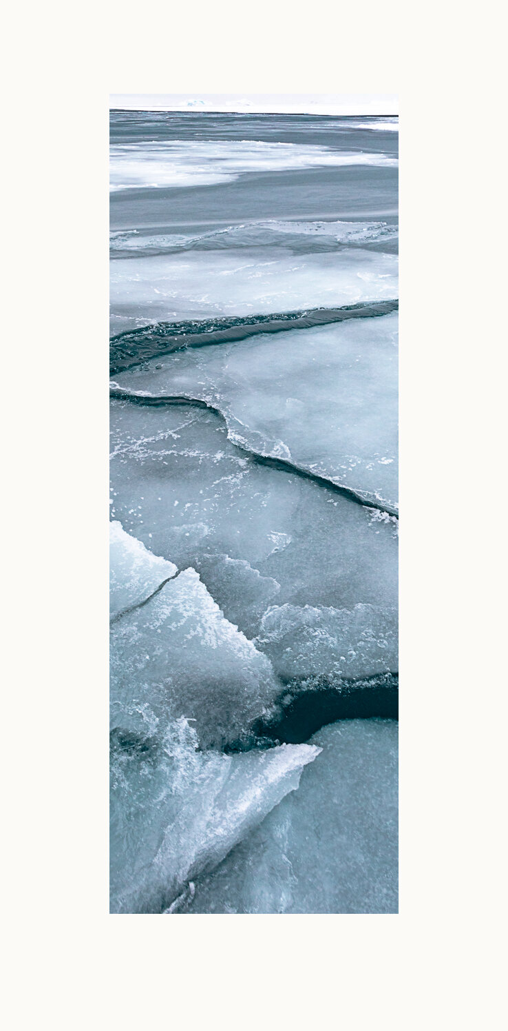
Cracked drift ice creates a pattern of interlocking puzzle pieces. Hornsund Fjord, Svalbard Archipelago, Norway, 2019.
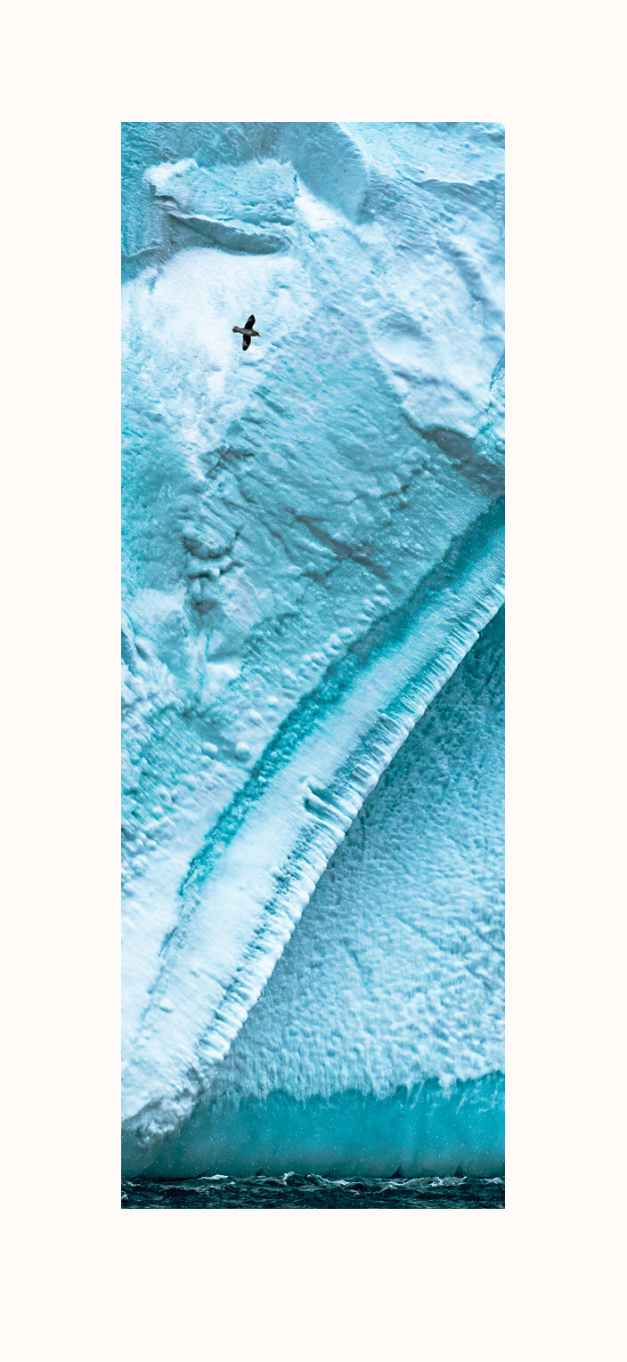
Near Velkomstpynten (welcome point), off Reinsdyrflya (reindeer plain) in the northwest corner of Spitsbergen Island, a northern fulmar traverses the tall face of an erosion-carved iceberg. Off Velkomstpynten, Svalbard Archipelago, Norway, 2019.
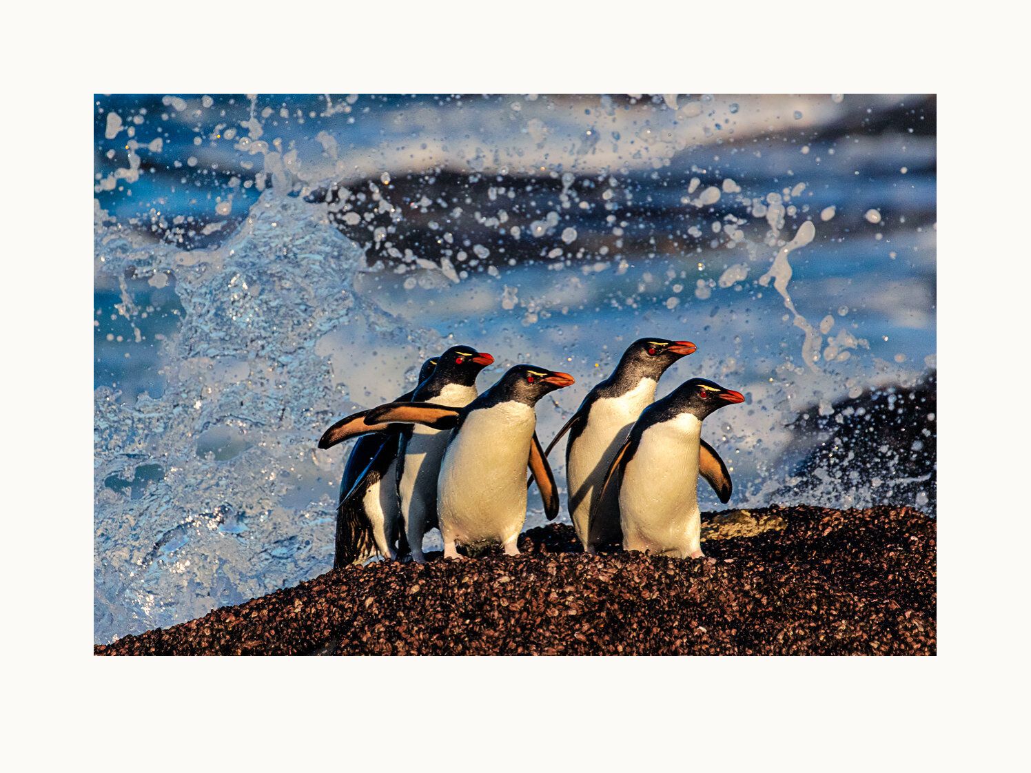
Southern rockhopper penguins dance ashore on Saunders Island. The island is run as a sheep farm, with a handful of isolated group structures for visitors. Those guests are primarily attracted by the abundant wildlife, which also includes king, gentoo and macaroni penguins, plus black-browed albatross and other birds. The Falklands archipelago is a British overseas territory. Saunders Island, Falkland Islands, United Kingdom, 2019.
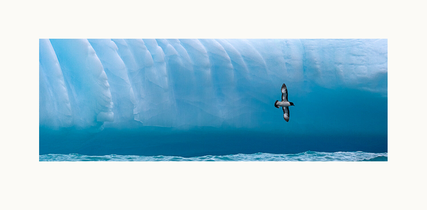
A cape petrel flies across the face of a large iceberg. Wave action at the water line has cut into the highly compressed (and therefore deep blue) ice there. The vertical channels may be a result of erosion. South Georgia Island is a British overseas territory. Gold Harbor, South Georgia Island, United Kingdom, 2016.
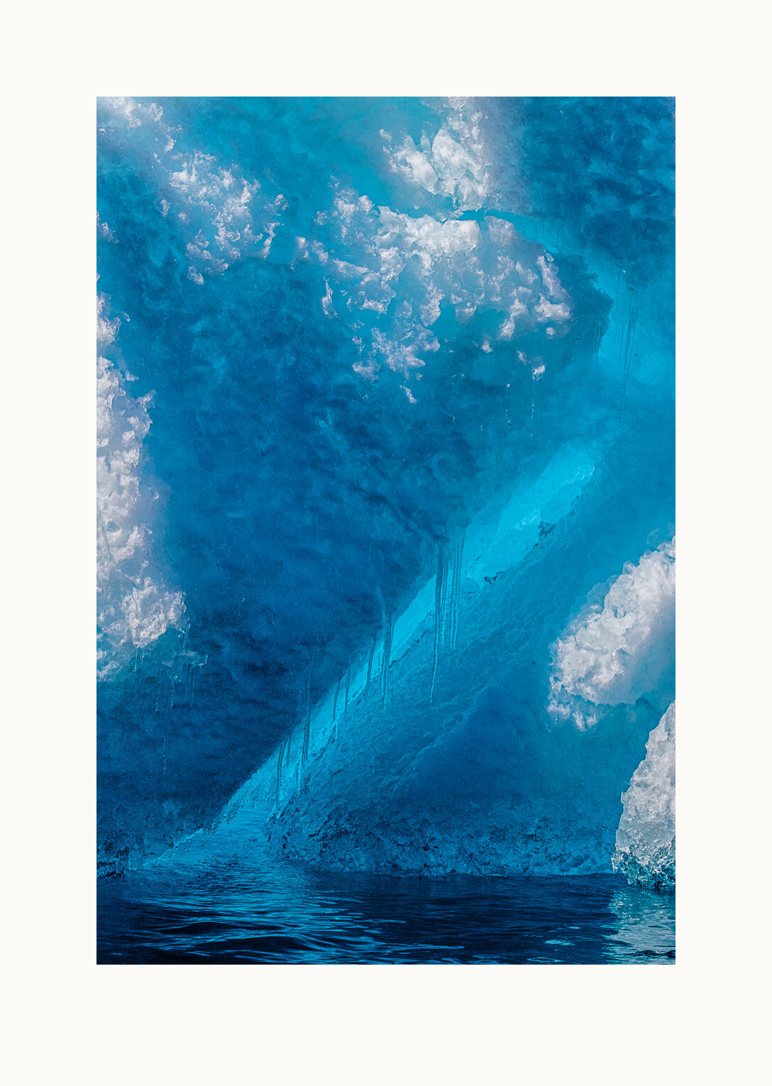
South of Cape Dubouzet, off the tip of the Antarctic Peninsula and at the edge of the Antarctic Sound, an iceberg close-up reveals exquisite blues. Off Cape Dubouzet, Antarctica, 2016.
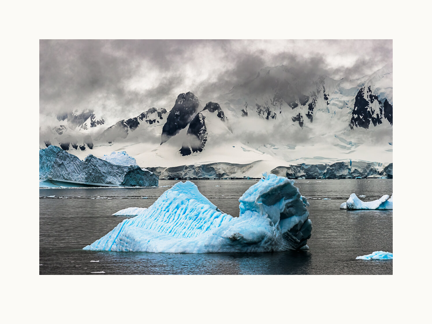
South of Cape Dubouzet in the Antarctic Sound, an iceberg shows the sculpting effects of wave and wind erosion. Off Cape Dubouzet, Antarctica, 2016.
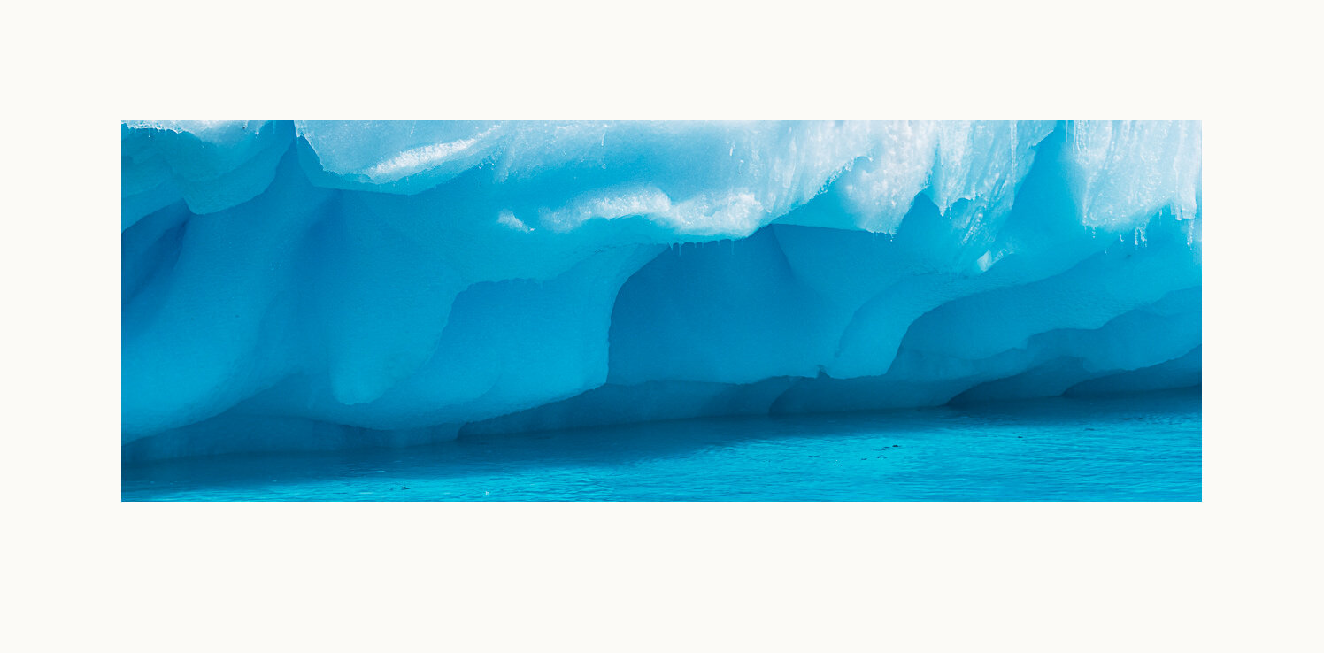
With the steep rocky slopes of Graham Land in the background, icebergs float in Charlotte Bay, Antarctica, off the Rectus Peninsula. Blue colors in the ice indicate it has been under intense pressure deep in a glacier, squeezing out embedded air. Charlotte Bay, Antarctica, 2016.
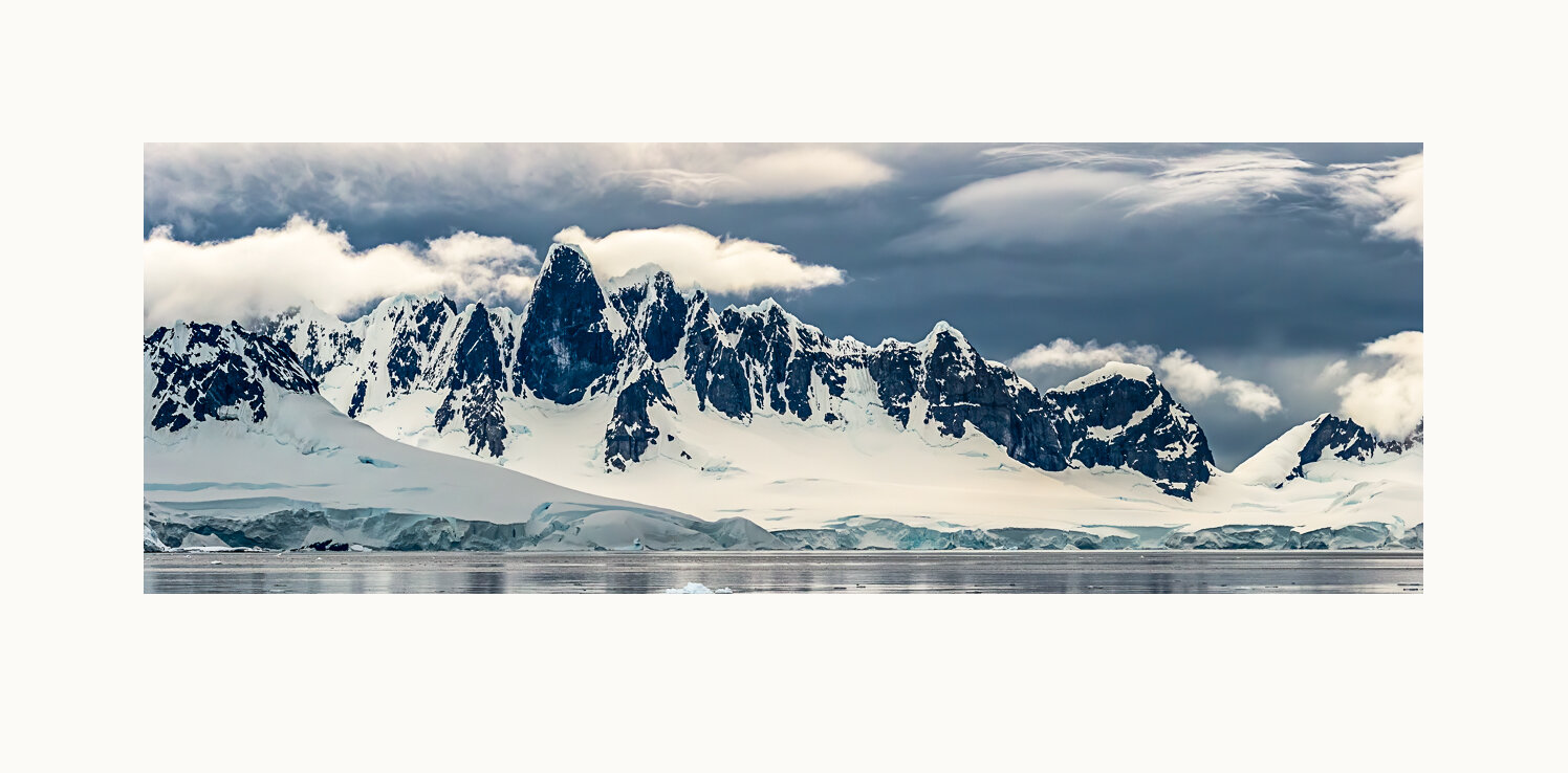
A dramatic rock escarpment on the Arctowski Peninsula towers hundreds of feet over the glassy waters of the bay. Wilhelmina Bay, Antarctica, 2016.